This fall the University of Mary Washington will roll out its master’s program in geospatial analysis. The 30-credit-hour program makes UMW one of only two Virginia schools to offer this advanced degree.
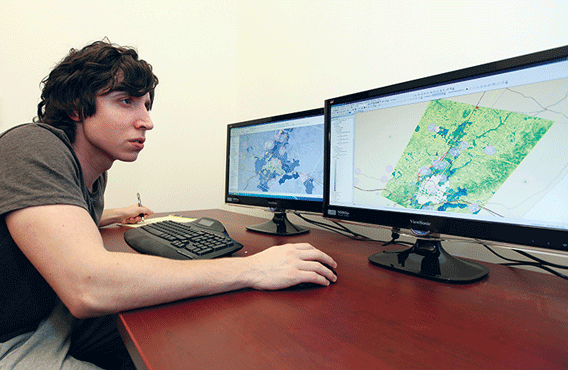
Jonathan Steenburg ’13 majored in geography and geogreaphic information systems and returned
to UMW to pursue a certificate
in geographic information systems.
Photo by Norm Shafer
Involving mapping and the study of spatial data, geospatial analysis is used to track phenomena affecting the Earth. Its applications are vast, including monitoring water supplies, tracking real estate values, solving crimes, managing crises, following climate change, and more.
The program, designed for recent graduates and working professionals, will combine technical training and theory with critical thinking, project management, and communication skills. It will prepare students for work in multiple areas, including urban and regional planning, all levels of government, and cartography.
Graduates will be poised to fill senior positions locally and across the country.